(Editor’s note: This is the fourth in a series of posts about the transition from the old Garfield Park “L” to the Congress expressway median line in the 1950s.)
FYI we have updated a couple of older posts, Garfield/Congress/CA&E Mystery Photos Contest Answers and Somewhere West of Laramie.
This construction project has always been one of my favorites, and I’m old enough to remember some of it too. I’ve been collecting images of it for the last 30 years, and recently found my notes, which give the exact dates for most of the photos in those two posts, and the names of the photographers. Most of those pictures were taken by Ray DeGroote.
The third previous post (Mystery Filmstrip Contest) will probably remain just that, a mystery. The name of the photographer is not known; this was simply a roll of developed film purchased on eBay. Yet another post (The Great Subway Flood of 1957) touches on this construction period, although that’s not the main focus.
We also recently devoted an article (Scenes Along the Garfield Park “L”) to the old Metropolitan “L” prior to expressway construction. Now, we return with more construction photos, from the days when service on Chicago’s west side combined elements of the new and old. We hope that you will enjoy them.
-David Sadowski
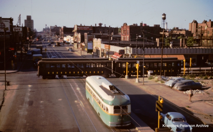
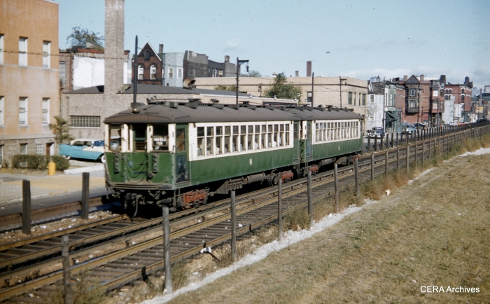
A CTA test train on Van Buren passes by CTA PCC 4385 on Western avenue in 1953. (Photo by William C. Janssen, Krambles-Peterson Archive)
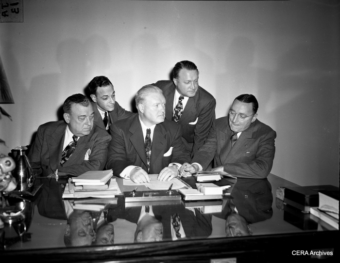
1949: “Chicago officials discuss Congress Highway plans.” (Photographer unknown)
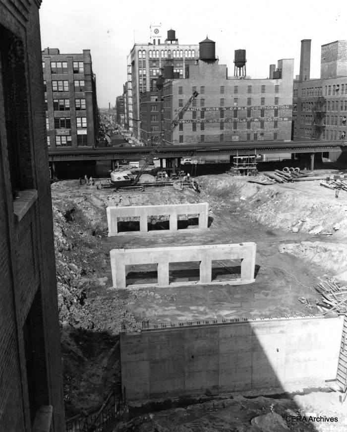
October 25, 1950: “The Congress st. superhighway is the remaining link in Chicago’s superhighway system. Here are the concrete piers for the Peoria st. bridge. The expressway will run under Halsted and Peoria sts.” (Photographer unknown)
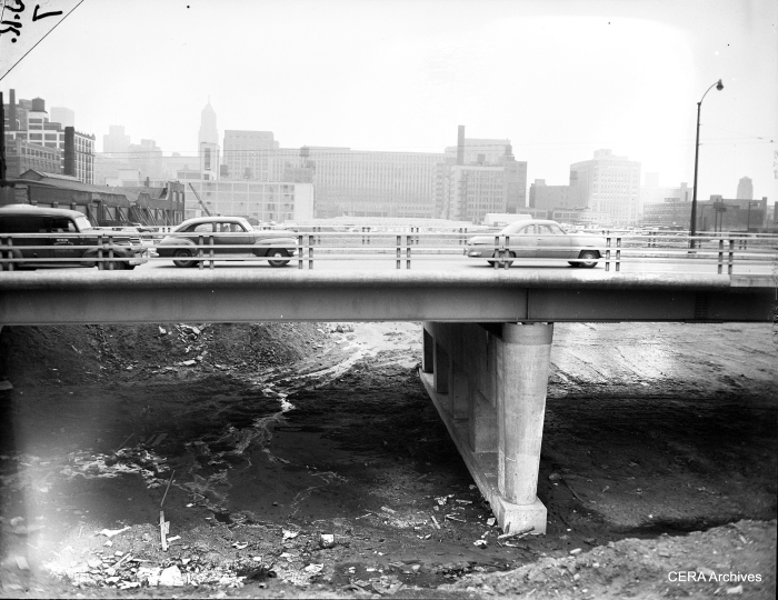
Some of the earliest work on the expressway involved digging out and building overpasses. That way, roads could be diverted around the affected area. (Photographer unknown)
May 8, 1952: A three-car CA&E train, heading eastbound, is closely following a CTA Garfield Park “L” train. According to Graham Garfield’s excellent http://www.chicago-l.org web site, CA&E trains “began stopping at Ogden station eastbound during the CTA® era, rather than at Marshfield, at the request of the Authority to clear up delays at Marshfield Junction. This lasted until the CA&E suspended service east of Desplaines on September 20, 1953.” The Ogden station closed one week later, as CTA trains were rerouted to Van Buren street at first only in one direction. (Photo by Joe Kordick)
A close-up of the same May 8, 1952 scene. (Photo by Joe Kordick)

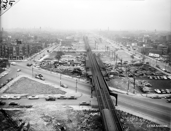
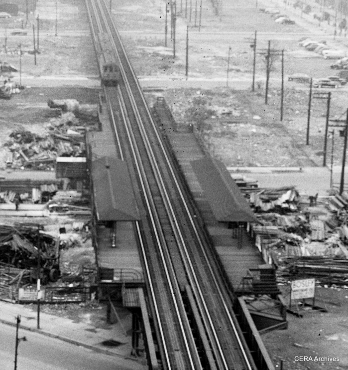
In this circa 1952 aerial photo, we are looking east near Marshfield Junction, where the three Met “L” branches split off from each other. By this time, the Dearborn subway had opened, leaving the branch at left only for shop moves. Two CA&E trains pass each other, while two CTA trains are in the station. The building in the foreground will need to be torn down soon to make way for the expressway. (Photographer unknown)
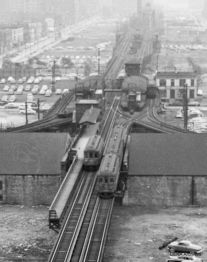
A close-up of the same scene. (Photographer unknown)
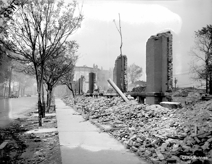
Expressway demolition in Chicago. (Photographer unknown)
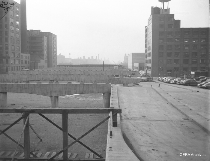
February 4, 1953: “Looking west from Canal street along the concrete structures already in place for the super highway.” (Photo by Joe Kordick)
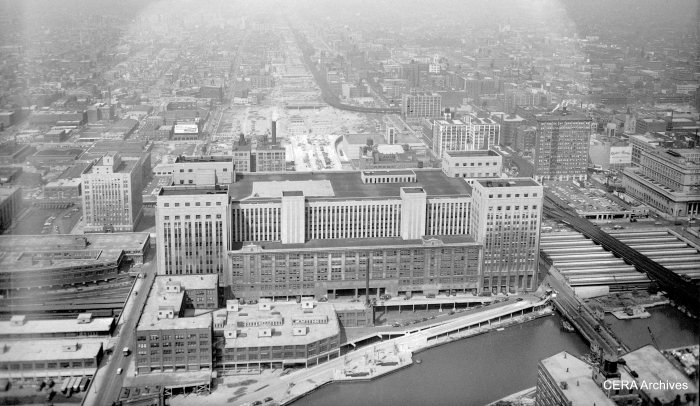
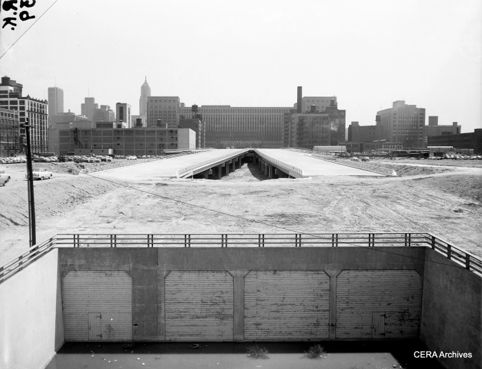
August 11, 1953: “The Congress St. Super Highway. Looking West from above the Post Office.” The Garfield Park “L” snakes around at right. As you can see, a space has been cleared for the highway in the middle of the old Main Post Office, but the bridge over the Chicago River has not yet been built. (Photo by Bob Kotalik)
Looking northeast at Ogden and the Congress highway circa 1953-54. By now, the old “L” has been torn down in this area, and the temporary Van Buren street right-of-way is just barely visible on the left side of the picture. (Photographer unknown)
A two-car train of CTA 4000s along the temporary Van Buren trackage circa 1954-55. (Photographer unknown)
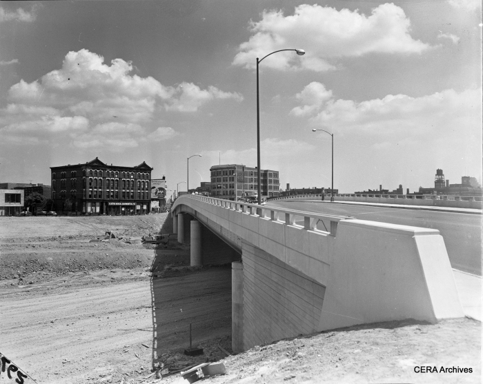
May 18, 1954: “Looking east at the super highway, from the Halsted Street bridge.” (Photo by Bob Kotalik)
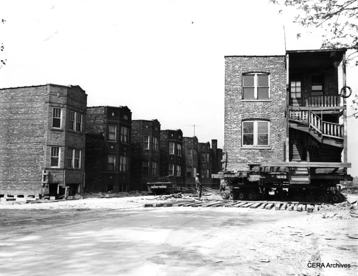
May 21, 1954: “Here’s a picture of a neighborhood ‘on the move.’ This two-flat is one of seven similar buildings in the 4900 block on Lexington moved from north to south side of street to make room for Congress st. expressway. Building was turned in middle of the street to slide it on new foundations at 4927 Lexington. Structures are moved on rubber-tired dollies lashed to the underside of steel and timber supports.” (Photo by Frank Las)

Congress St. and Pulaski, July 28, 1955: “General view of the ceremonies of the driving of the golden spike by Mayor Daley.” (Photo by Arvidson)
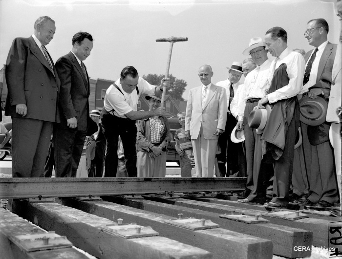
Congress St. and Pulaski Rd., July 28, 1955: “Mayor Daley drives the golden spike in the Congress Street strip to lay the first rail in the Congress St. Superhighway.” (Photo by Arvidson)
December 15, 1955: Ceremonial ribbon-cutting as the Congress expressway is opened between Ashland and Laramie. Cook county Board President Dan Ryan, Jr., Gov. William G. Stratton, and Mayor Richard J. Daley officiating. (Photographer unknown)
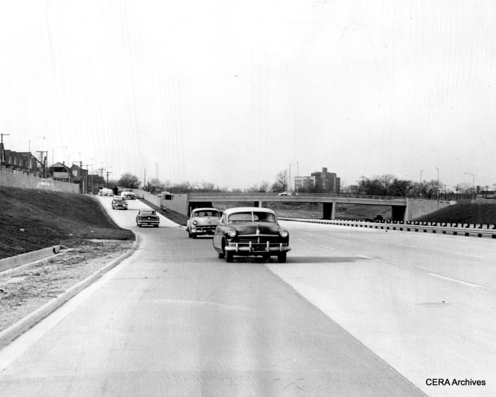
December 15, 1955: “Cars enter completed 4 1/2-mile strip of Congress st. expressway at Laramie av. Impatient motorists jumped the gun.” One reason that the expressway could not continue west of here was that the CTA rapid transit line crossed the expressway footprint at grade. We are looking west in this view. (Photographer unknown)
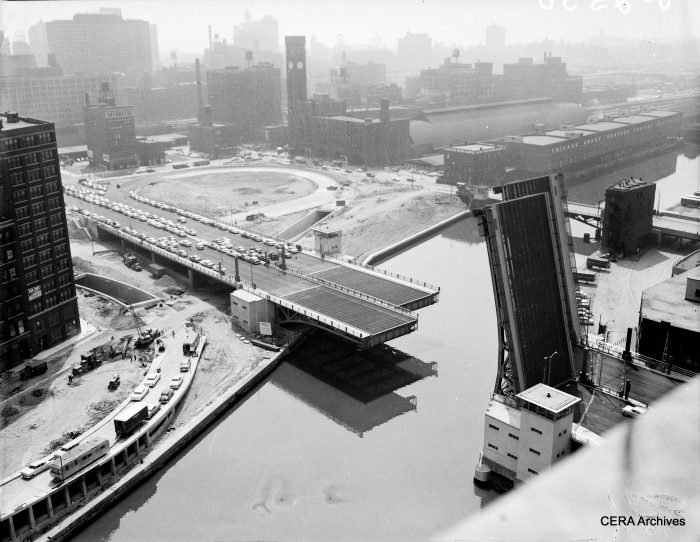
August 3, 1956: “Twin-bridge across the Chicago River which will open to traffic Aug. 10, when the Expwy. itself will be open to the public from Ashland Ave. to Michigan Ave. New type of device permits the bridgetenders to see clearly whether the bridge is fully closed or partly open even during the densest fog or on the darkest night.” (Photographer unknown)
Congress at highway, 1956. (Photographer unknown)
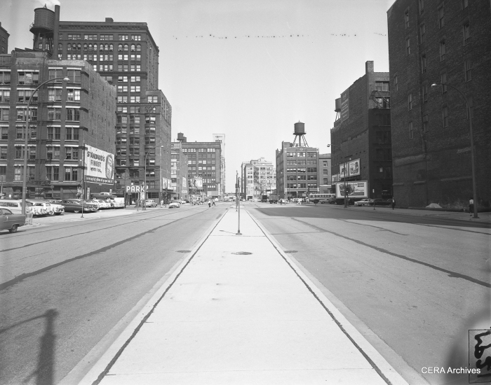
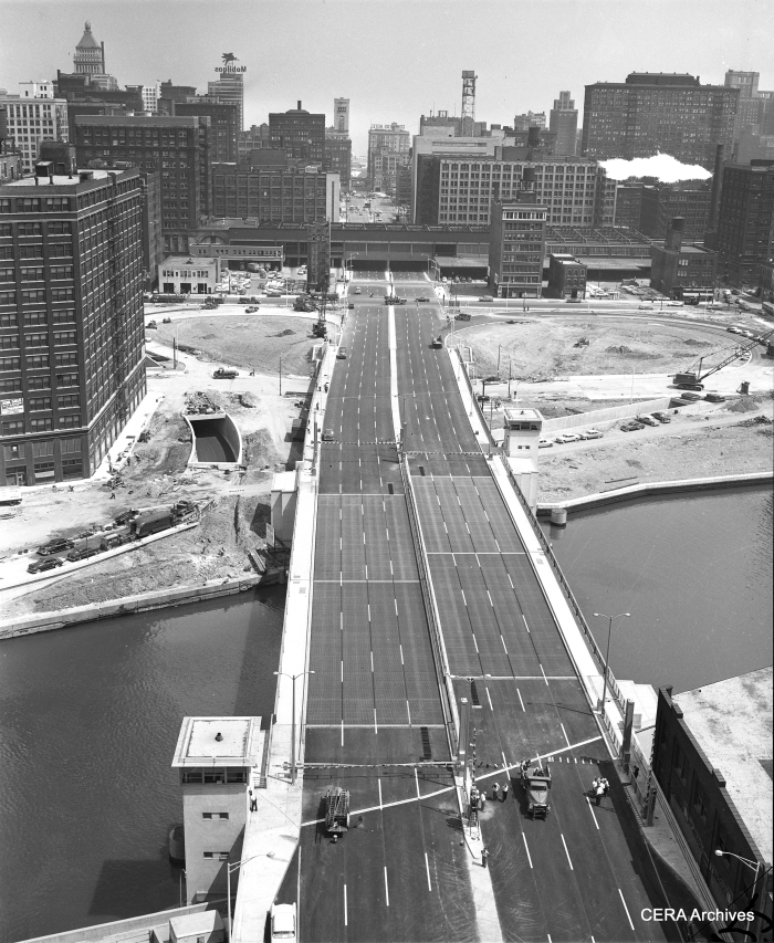
August 6, 1956: “Looking east from Clark street showing the wide sweep of Congress street through the Chicago Loop.” (Photo by Merrill Palmer)
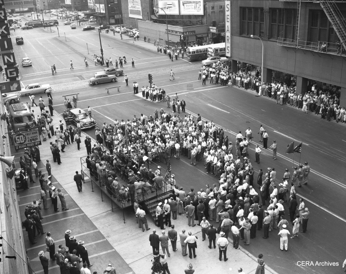
August 10, 1956: Ceremonies marking the opening of the downtown stretch of the Congress expressway. Note the PCC car in the background. (Photographer unknown)
This picture was most likely taken late in 1956, soon after this portion of the expressway opened to traffic. We are looking east near Halsted. Tracks have not yet been put in the median. The Garfield “L” curves off at left and would continue to operate here through June 1958. (Photographer unknown)
The Congress Expressway circa 1956-7. Tracks are in the median, but no third rail or stations yet. Meanwhile, the old Garfield Park alignment was still in place, including the double-island Halsted “L” station. (Photographer unknown)

An aerial view taken on June 6, 1957. By this time, the expressway was open as far as Laramie. The Garfield Park “L” is at left. (Photographer unknown)
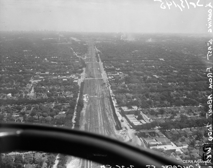
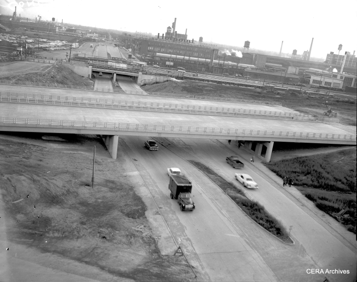
An aerial view of the Congress expressway under construction on July 25, 1957. The view is looking east from about 7000 west. (Photo by Burley)
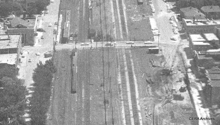
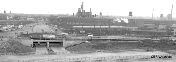
A close-up view showing the CTA’s temporary station at Oak Park avenue on July 25, 1957. The B&O freight tracks are at right. Everything here is still at ground level.The CTA tracks have been moved to the north. Note that the eastbound and westbound platforms are on opposite sides of Oak Park avenue. The highway would not open in this area until more than three years later. (Photo by Burley)
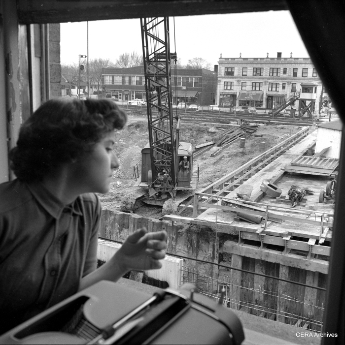
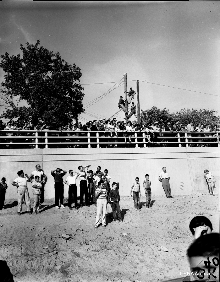
Watching expressway construction in Oak Park in 1959. By now, both the B&O freight line and the CTA rapid transit line are still running on the surface, but in a temporary alignment at the north end of the highway footprint. (Photographer unknown)
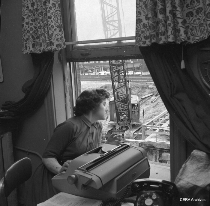
Watching expressway construction in Oak Park in 1959. (Photographer unknown)
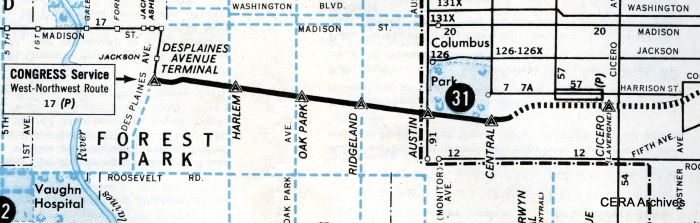
This 1959 CTA map shows the temporary stations on the then-new Congress line between Central and DesPlaines. This included a station at Ridgeland, replacing a Garfield Park station at nearby Gunderson, but no permanent station was put there. CTA opted to use secondary entrances instead at both East Avenue and Lombard. The Central stop was not successful and was closed in 1973.
January 7, 1960: Looking south on Central, we see the uncompleted expressway and the temporary CTA platforms. According to http://www.chicago-l.org, “On October 16, 1959, the permanent eastbound Congress Line track was placed in service between Parkside and Pine avenues thru Lotus Tunnel. A temporary side platform was placed in service. Three days later, on October 19, the permanent westbound track and a temporary westbound side platform was placed in service, closing the previous temporary platform. Meanwhile, between the permanent tracks, the new, permanent island platform was constructed. The new Central station platform (with temporary fare controls) was placed in service on October 10, 1960, with westbound trains first using it, followed by eastbound trains the next day. On October 11, 1960, the third and final temporary Central station was closed.” (Photographer unknown)
A close-up of the temporary Central avenue platform as it looked on January 7, 1960. (Photographer unknown)
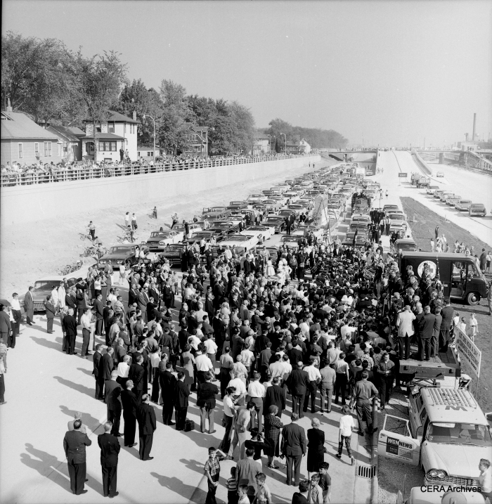
October 12, 1960: “Crowds line sides of Congress Expressway to see opening of final stretch from Central to 1st Ave.” (Photo by B. Kotalik)
October 12, 1960: “Looking down from overpass at formal opening of Congress Expressway.” (Photo by Zack)
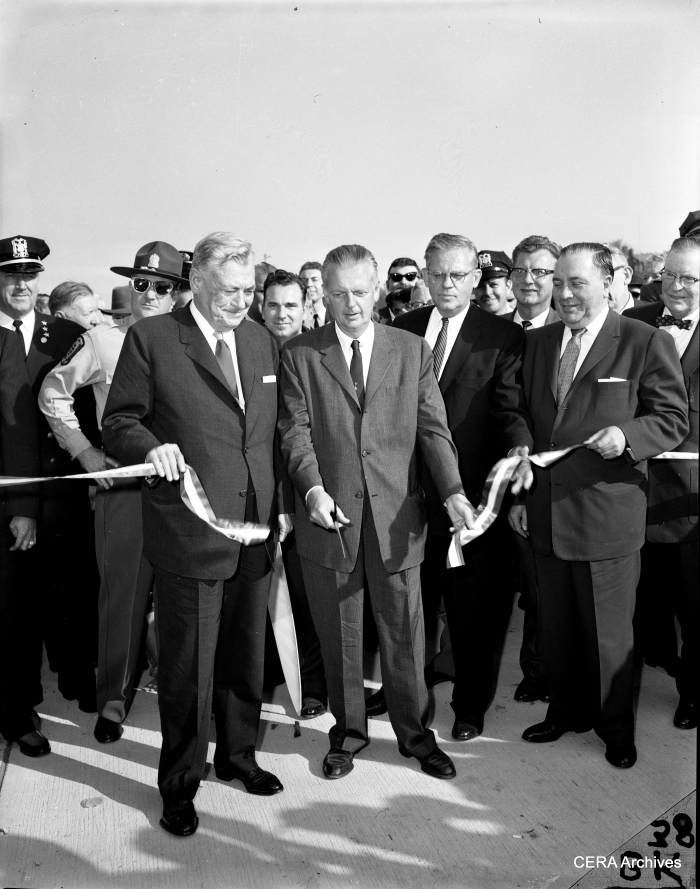
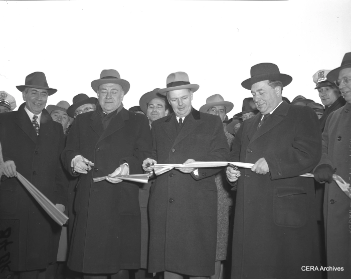
Opening the last section of the Congress expressway, 1960. Gov. William Stratton cuts the ribbon, while Cook County Board President Dan Ryan, Jr. and Mayor Richard J. Daley look on. (Photographer unknown)
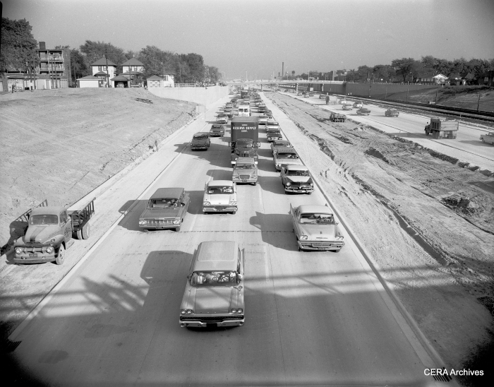
October 12, 1960: “Solid pack of cars passing thru Congress expressway after formal opening of the last link between Central and 1st Ave.” (Photo by B. Kotalik)

The “temporary” CTA terminal at the end of the Congress line in 1959. The platform at right is where CA&E cars would have transferred passengers to CTA, if the interurban could have resumed service after highway construction. (Photographer unknown)