Vern Hallas writes:
I am a big fan of the Chicago “L” system and found part 4 of From Garfield “L” To Congress Median via a link from Chicagobus.org. I LOVE this stuff, especially the old pictures. Is there anywhere I can see the 3 previous parts? I would very gladly become a CERA member if necessary.
Thanks for writing. We always hope people will enjoy the posts, and naturally, we encourage everyone to join CERA. You can purchase a membership online, by mail, or at one of our 10 yearly program meetings. For more information, go here. We thank you for your support.
To find all our blog posts that feature the Garfield Park “L”, just go to our home page and type “Garfield” in the search window. That will bring up all the other posts, which have various headline titles.
Meanwhile, here is another generous helping of period photos for your enjoyment.
-David Sadowski
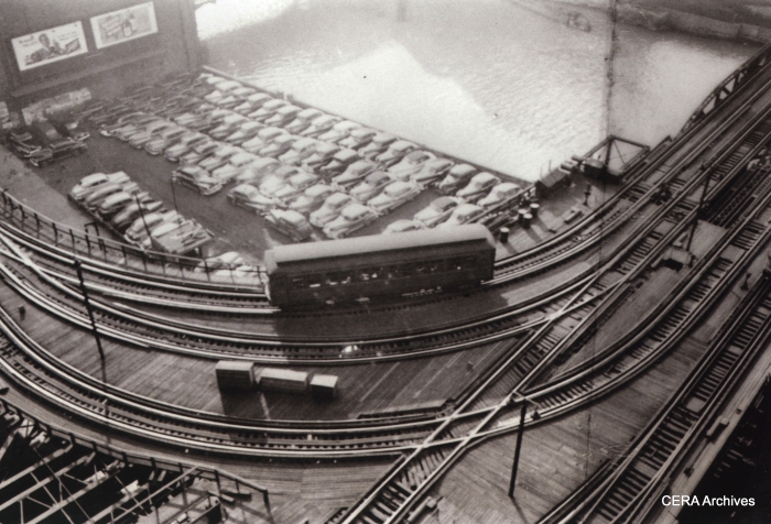
A lone Met “L” car heads toward the Loop in 1949. There were four tracks crossing the Chicago River at this point, on two parallel bridges. The tracks at the bottom of the picture led to the Wells St. terminal. In 1955, the tracks at left were torn out due to the construction of this part of Lower Wacker Drive, and a new connection to the Loop “L” was created by bridging the short gap with the gutted Wells St. Terminal. (Photo by Stanley Kubrick)
PS- The photo by Stanley Kubrick (yes, the famous film director) was taken in 1949, while he worked as a staff photographer for LOOK magazine. This was “work for hire,” and when LOOK folded in 1971, the publisher donated their photo archive to the Library of Congress:
Cowles Communications, Inc., transferred all of its copyrights in the LOOK Magazine Photograph Collection to the United States, but asked that the Library convey Cowles’ desire that the photographs are “Not to be used for advertising or trade purposes.” The Library cannot provide further interpretation of this phrase.
We are certain that our use of the photo complies with Cowles Communications’ intentions.
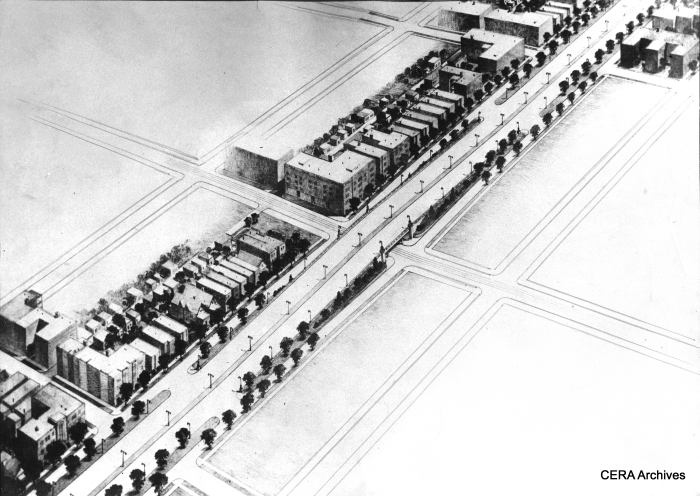
February 8, 1938 – “An architect’s sketch of proposed overpasses to be built at half-mile intersections… the proposed Congress street improvement under a plan for two highways through the West Side which has been recommended to Mayor Kelly by his committee of six engineers. They proposed that the second route, an elevated superhighway, be constructed in Kinzie street or Lake street. They suggested converting the Lake Street Rapid Transit structure into a motor road. Immediate action was urged by aldermen and property owners today.” (Photographer unknown)
This early highway plan is somewhere between what actually got built, and the original boulevard in Daniel Burnham’s 1909 Plan of Chicago. The 1938 version was an elevated highway, which would pass over intersections. There is no trace of a rapid transit median, and the Kelly administration favored express bus service instead. As built, very little of the Congress expressway was elevated.
Oddly enough, in this highway illustration, there are very few autos. In real life, the expressway soon became clogged with cars, and rush-hour gridlock soon became an everyday occurrence.
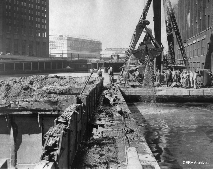
September 22, 1947 – “End Subway Hunt. The lost is found! Armed with steel claw, crane strikes pay dirt after three swings and locates remains of unused 200-foot tunnel in river near Congress st. Tube will be sealed to prevent interference with new Congress st. subway.” (Photographer unknown) What tunnel was this?
While the Dearborn-Milwaukee subway was said to be “80% completed” in 1942, when construction was halted due to WWII materials shortages (including steel subway cars), “phase one” of Chicago’s second subway ended abruptly at Dearborn and Congress. Phase two, which did not start until after WWII, brought the subway west along Congress street, under the Chicago River and the old Main Post Office, to emerge near Halsted and run in the highway median. The subway opened as far as LaSalle street in 1951, and under the river starting on June 22, 1958.
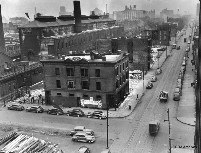
March 11, 1949 – “This isn’t a London bombed area, but a view of Van Buren st. looking west from Racine av, as demolition continues for the Congress st. superhighway. Vacant areas indicate where wrecking crews already have torn down structures. Other gaunt, vacant buildings have been emptied by the relocation office and will soon fall, including the CTA car barn.” (Photographer unknown)
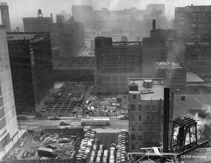
March 11, 1949 – “Land that once was congested with Loop skyscrapers appears now as a deep cut through the Loop looking west from a building on Dearborn st. The new superhighway, eight lanes wide, will pass under the LaSalle st. station tracks, over the river and through the arcade in the Post Office (background). The cleared site in the immediate foreground once was the location of the 13-story Monon building, since razed by the Dept. of Subways and Superhighways. (Unknown Photographer) Note the PCC streetcar.
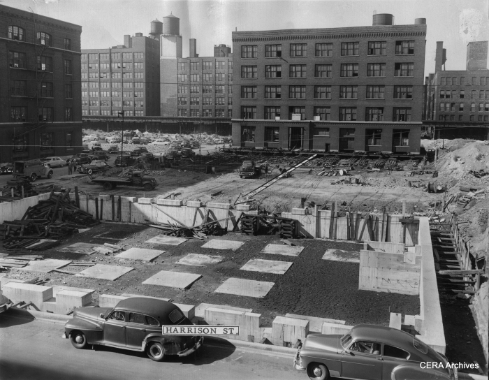
September 2, 1949 – “Arrow indicates path in which five-story building is being moved from Congress and Peoria sts. to its new foundation (foreground) at Harrison and Peoria sts. to make way for Congress st. superhighway.” (Photographer unknown) The Garfield Park “L” is visible in the background.
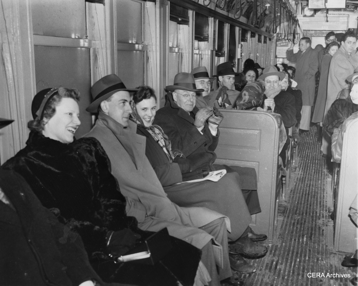
February 24, 1950 – CTA “L” riders were cheerful despite the obvious lack of amenities on the trains. “A rush hour crowd shivers aboard an elevated train. They were victims of Chicago’s first zero cold snap today, which happened at the same time that the transit authorities cut off all heat in their vehicles to conserve coal. The result: cold customers.” (Photographer unknown)
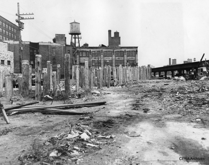
September 24, 1951 – “Going ahead with plans for shunting Aurora & Elgin trains and elevated trains to streetcar tracks in Van Buren, between Racine and Sacramento blvd., wooden pilings are driven to support structure bringing the tracks to street level.” (Photographer unknown) As we know now, CA&E refused to use the Van Buren street-level trackage. Calling it “streetcar” trackage was a bit of a stretch, since ultimately third rail was used and the right-of-way fenced off from traffic. However, calling it that may have been the means used to justify operating trains without crossing gate protection.
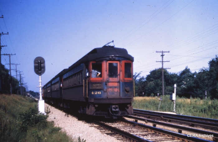
CA&E 426 eastbound near First Avenue in Maywood in 1952. (Unknown photographer)
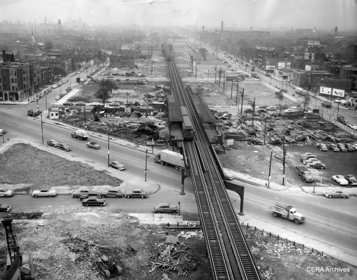
May 8, 1952 – “Looking west from Wood along the way of the (Congress) Superhighway.” (Photo by Joe Kordick) This image was taken just prior to one in part 4 of this series. A two-car Garfield Park “L” train stops at the Ogden station, closely shadowed by a three-car CA&E train, which will also stop there to discharge passengers (instead of at Marshfield, which CTA considered a bottleneck).
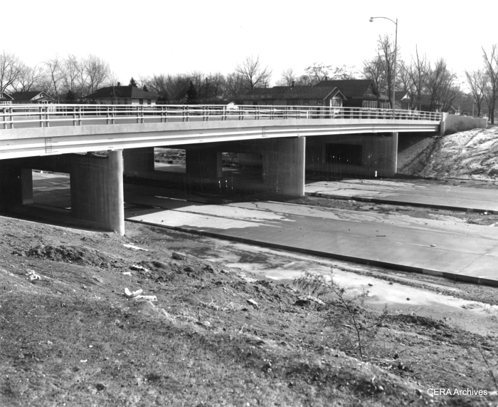
February 10, 1954 – “Most of the paving that has been done on the highway has been done in Maywood. This is the scene at 5th av., Maywood, where an overpass crosses the highway.” (Photographer unknown)
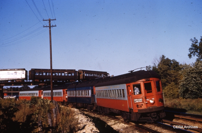
CA&E 427 westbound at Des Plaines in September 1954. A CTA Garfield Park train loops in the background. (Unknown photographer)
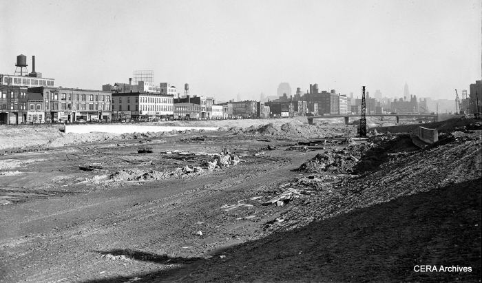
The Congress expressway under construction, circa 1954. We are looking east from about Ashland (1600 west). The CTA temporary trackage on Van Buren is at the left. (Photographer unknown)
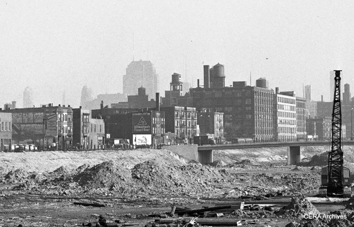
A close-up of the same scene, showing a CTA two-car train of 4000s on the Garfield Park route. The bridge is at Loomis (1400 west). (Photographer unknown)
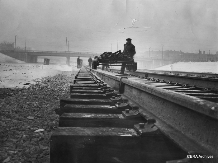
February 9, 1956 – “Congress at expressway about 2900 west. Workmen brave the bad weather to continue completion of rails on the Congress st expressway. They fasten down rails with brackets and spikes.” (Photo by Larry Nocerino)

July 1, 1957 – New stations, Congress Expressway and Keeler Ave. Boller Boll and Bill Magorn, iron workers, working on the aluminum support columns at the station. (Photo by Bill Knefel)
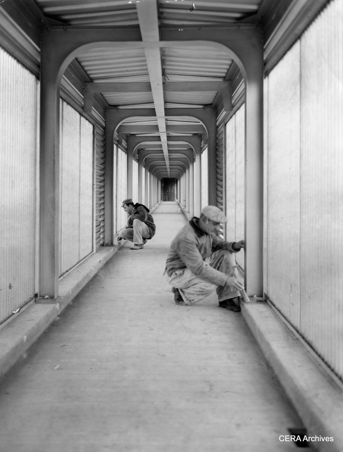
December 9, 1957 – “Congress Expy. and Cicero: Dale Mueller, tile setters’ helper and Tom Shue, tile setter, work on the inside of the ramp that leads to station.” (Photo by Knefel) The full-length fiberglass panels on these station ramps soon became a problem, since they shielded anyone in the tunnel from view and were considered havens for crime. Eventually they were partially removed.
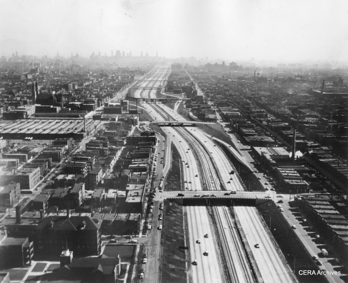
In this January 1958 view, we see both the unfinished Congress median line and the Garfield Park “L”. Just above the middle of the photo, the “L” crosses from the north to the south of the expressway at Sacramento. Motorists apparently had to dodge support columns right in the middle of the highway. The “L” section at right continues west before crossing the highway yet again, while at left trains descend a ramp down to temporary trackage in Van Buren street. (Photographer unknown)
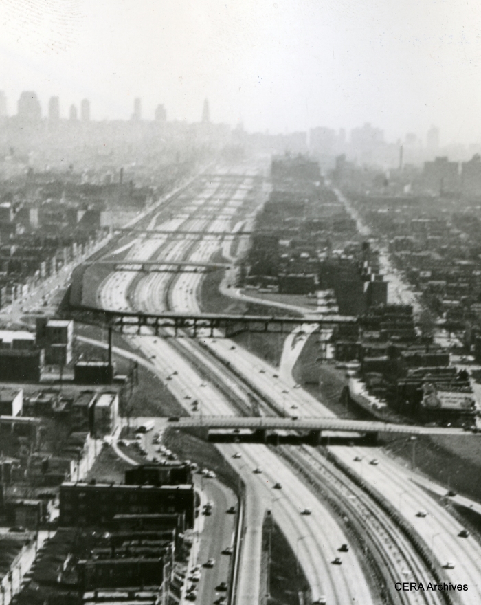
A close-up of the same January 1958 scene. (Photographer unknown)

April 7, 1958 – “View looking northeast from Paulina and the Congress expressway shows progress of work on a ramp that will link the Douglas Park elevated branch with the median strip of the expressway. The median strip will be used by both Douglas and Garfield trains to enter the Milwaukee-Dearborn subway near Halsted.” (Photographer unknown) Today, Pink Line trains continue to the left and run downtown over the Lake/Green Line route via the Paulina connector. (Note a CTA train of 6000s in the picture, running on the temporary Van Buren street trackage.)
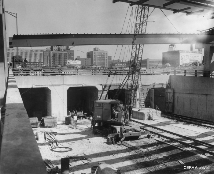
June 10, 1958 – ‘Pictorially, you are “entering” Chicago’s new CTA subway which will open June 22. The subway proper runs under the Congress Expressway from Halsted to link with the Dearborn-Milwaukee subway at Dearborn. Trains will enter the subway from an open cut in the expressway, on which they will travel from Lockwood (5300 west). Ultimately the western terminal of the expressway run will be at Desplaines av., Forest Park. From Lockwood to Dearborn, the trains will take just 14 minutes. The scene here is looking east from Halsted at the start of the subway proper. A crane hoists a beam into place for auto traffic interchange at this point.” (Photographer unknown)
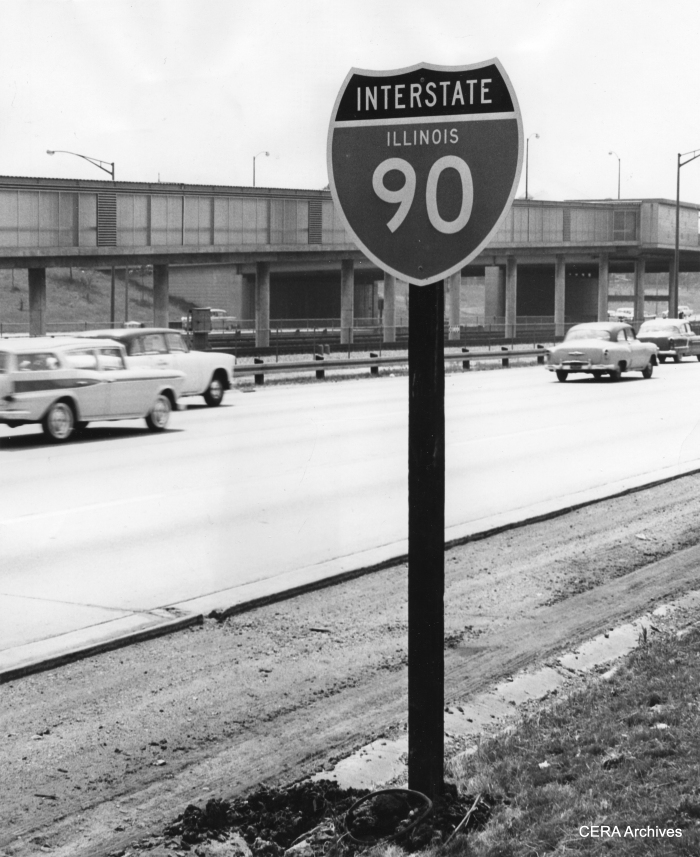
June 5, 1959 – “New sign on the Congress Street expressway on the west bound side.” (Photo by Luther Joseph) The Congress (now Eisenhower) expressway was planned before the Interstate Highway System, but eventually became part of it.
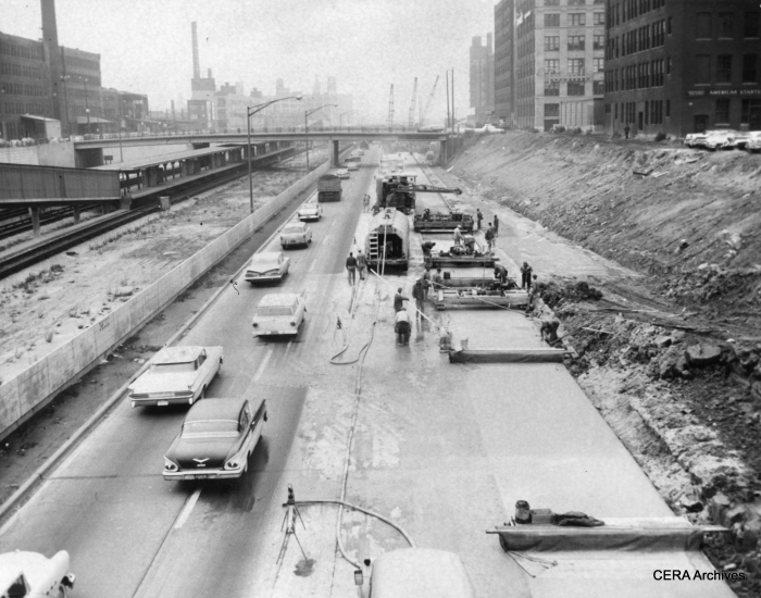
October 30, 1959 – The old Garfield Park “L” structure, which used to run parallel to the expressway in front of the buildings at the right of the picture, has been out of service for more than a year and has been torn down in this area near Halsted. The space once occupied by the “L”, to some extent, allowed the expressway to be widened at this point. (Photographer unknown)
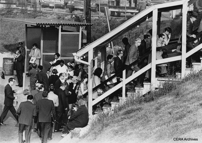
May 18, 1971 – Here is a view of some of the spartan amenities at the “temporary” CTA terminal at Des Plaines avenue that commuters endured from the 1950s to the 1980s. The crowds were swelled by a commuter rail strike. (Photo by Bill De Luga)